


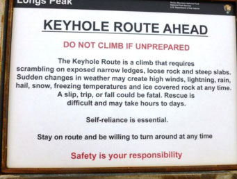
Difficulty: Class 3
Exposure: Significant
Summit: 14,255 feet
Elevation Gain: 5,100 feet
Roundtrip: 18 miles
Trailhead: Longs Peak at 9,400’
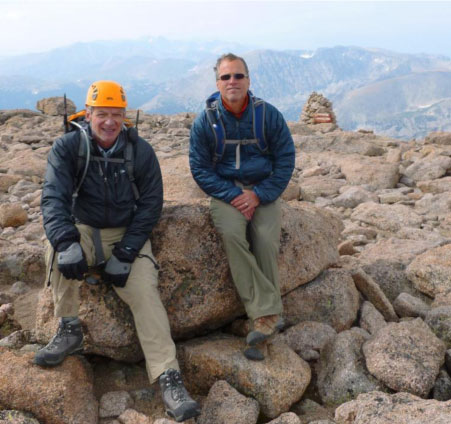
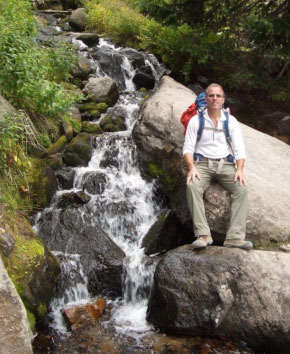
Climbers: Rick Crandall, Rick Peckham August 22, 2012
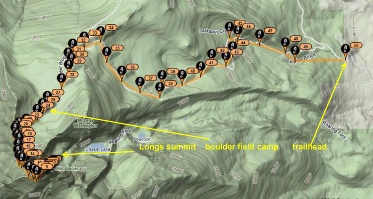
Longs Peak – the only fourteener in Rocky Mountain National Park was named after Stephen Long, an explorer in the area in the 1820’s. It is dubbed one of the most difficult Class 3 fourteeners in Colorado. The total vertical of 5100’ is a bigger bite than I can chew in one day, so we chose to reserve a campsite at what’s called the boulder field, which is a rocky field located at 12,700’. This is incredibly high particularly for sleeping. This would allow us to start the next day with the famed “keyhole” gateway to the more difficult stuff. The game plan was to backpack up 7 miles and 3300’ from trailhead to the boulder field, set camp and go for the summit early the next morning.
A big gamble was the weather. We’ve been getting electrical storms as part of the summer monsoons in Colorado and an electrical storm at that elevation with no protection 1000’ above tree line would be “exciting” as one report read. Weather would again be a risk during the climb – turning “grippy” steep rock faces into a sliding pond.
We traveled from Aspen towards the Longs Peak trailhead about 30 miles from Golden along a state road. On the way, we came around a curve and were confronted with the town of Black Hawk – which felt like an amazing drop into the twilight zone. Here in the middle of nowhere was a Las Vegas style gambling town, complete with huge video screens, lights, casinos and even a 33 story hotel!
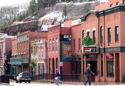
I had to research it – and I learned that Black Hawk is a Home Rule Municipality just like Aspen. It has a population of 118, the least populous town in Colorado!
The 118 is made up of 85% white and less than 1% Native American. It was favored by the state for gambling, but has outlawed bicycling in a twisted sense of priorities. I have no idea how it got financed, but it’s huge.
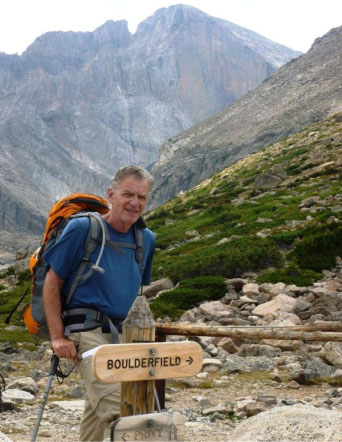
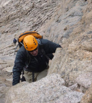
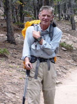
So we arrived at the Ranger Station and set out backpacking to the boulder field at 11:45am. I did this climb with Rick Peckham, a friend from Alaska who is a fit hiker/climber, ex-military search and rescue and a trained paramedic. Turns out what I needed most on this climb, in addition to a great companion, was his strong arm once or twice.
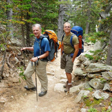
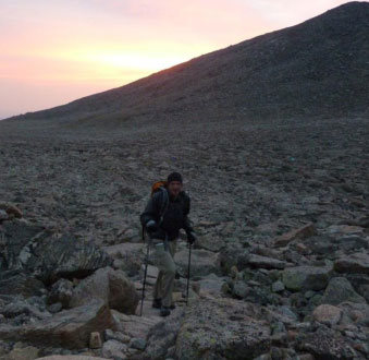
Rick C. and Rick P. with packs loaded head up to the boulder field.
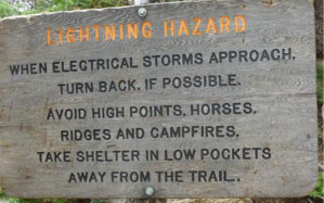
This was a warning at tree line (11,700’)
Just above tree line, Longs Peak comes into view – which looked very tall and still quite far away.
We arrived at the boulder field at about 4:20 pm (a 4 ½ hour backpack) and found our reserved campsite. This was a different campsite than anything I’d experienced – boulders pushed away to make a circle – and the challenge of falling asleep at 12,700’. As you can see, there is zero protection if a storm hits – and nowhere to go for miles. However we did have the weather on our side and the night was clear.
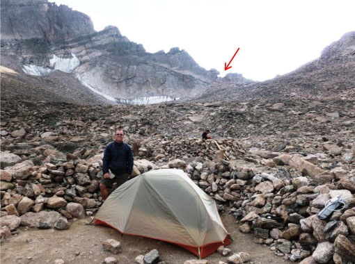
Rick P. standing at my tent. The arrow points to the “keyhole” which is the gateway to the real climbing on the other side. The boulder field would be navigated at pre-dawn with headlights.
There are only nine sites and you can only book by snail mail well in advance – so it’s a real shot in the dark with the weather. You don’t want to be up there without a commitment of a site, there’s nowhere else to set a tent!
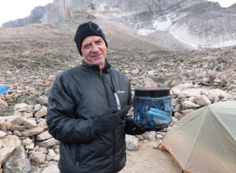
One of the requirements of the Park is to purchase a “bear-proof” food container (for $65), not so much to protect from bears at that elevation, but from marmots, who are talented thieves. Fitting that in an already crammed backpack was a hassle.
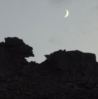
Nightfall at the keyhole with a crescent moon pointing the way for the next morning.
The next morning, we started an hour later than we’d planned in hopes that it would be daylight at the keyhole. We’d heard how steep it is immediately on the other side and we didn’t want to do that in the dark.
Rick C. at 6:15am headed towards the keyhole.
Rick P. at the keyhole, with winds blowing a good 30 mph through it.
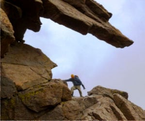
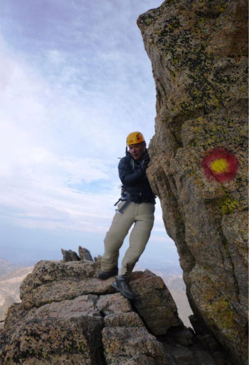
This is how it looks on the other side of the keyhole. The red/yellow bulls eyes were welcomed trail markers all along the way, without which … well getting off-route in this climb would likely not end well.
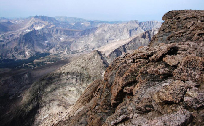
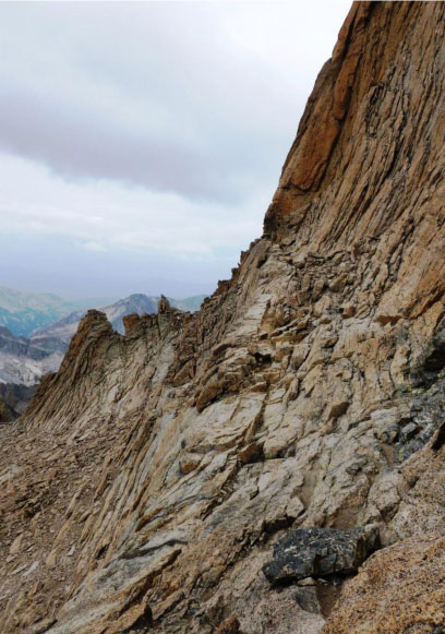
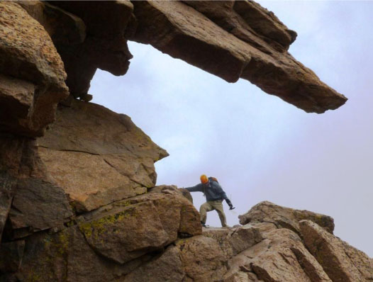
What follows is a serious climb, not just a mountain hike – many Class 3 pitches that are steep, at times loose and at times on polished rock which only gets worse with wet weather.
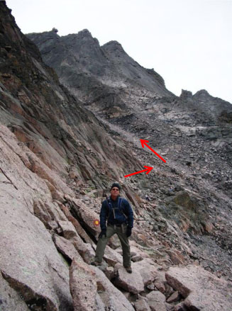
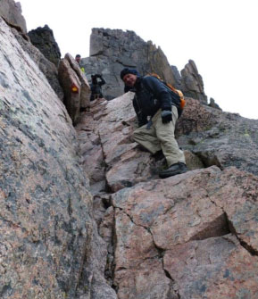
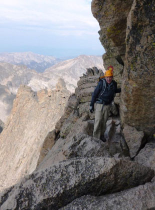
Rick P. headed along the narrow “ledges,” some areas of which had steep drop-offs on the right side. Our aim was the “trough” shown with an arrow – steeper than it looks, and loose. The route to the summit is off to the left, can’t be seen here.
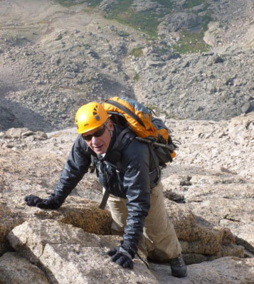
OK, enough of Rick P. Here’s Rick C. doing good with his new “grippy” sole boots purchased on the advice from son, Brett.
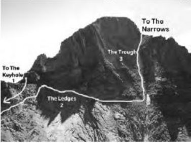
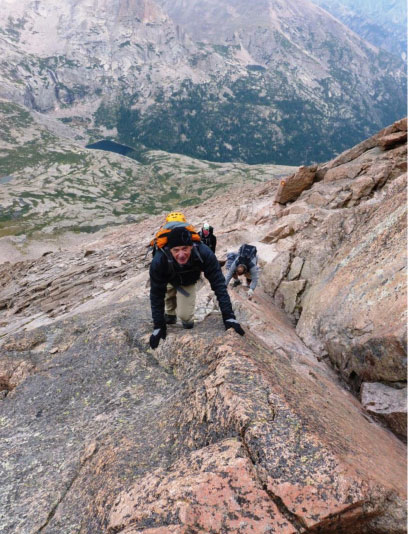
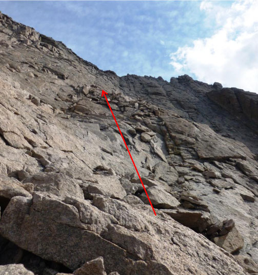
Heading up the 800’ Trough – loose rocks, so it’s helmet time. The photo showing part of the route gives you a feel for how steep the Trough is.
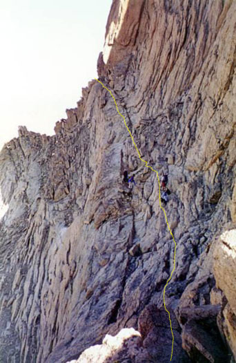
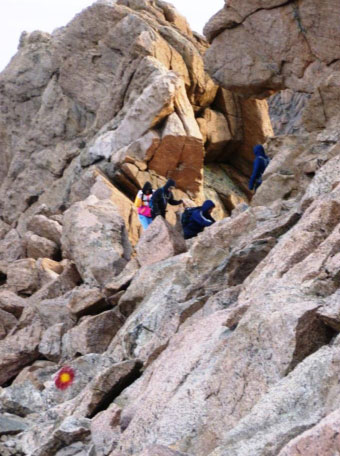
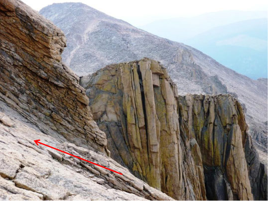
Next is the “Narrows,” best described as “crossing sheer vertical rock faces on a narrow ledge.”
Look carefully to see the climbers along the yellow dotted line. The wind was blowing like crazy.
Good lateral room, but exciting drop-offs – no tripping here!
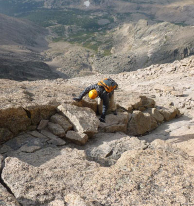
Finally, here’s what they call the “Homestretch,” described as 300’ of steep polished granite rock guarding the summit. You scamper up any way you can to find solid rock and handholds.
The views along the way were as stunning as the climb itself.
Summit: Longs Peak 14,259’
9:50 am, 3 ½ hours from camp at the boulder field.
Great views from the summit – currently one of the only fourteener climbs in the State without the smoke which has plagued the State from the Western state fires.
As we planned our descent, I noticed a broad weather-front coming in – not a good thing if it started raining before we got down through all the steep slippery rock faces – and something worse if it turned electrical.
We got down the Homestretch; here is Rick P. back in the Narrows, weather still holding with just a few light sprinkles, luckily not enough to make the rocks really wet.
At the top of the Narrows is what some describe as the “crux” of the climb – and there was actually a rope to help. Going up, Rick P. went up first, leaned over and grabbed my hand and hoisted. Going down I depended more on my boots and foot-cracks – but note I had a grip on the rope just in case.
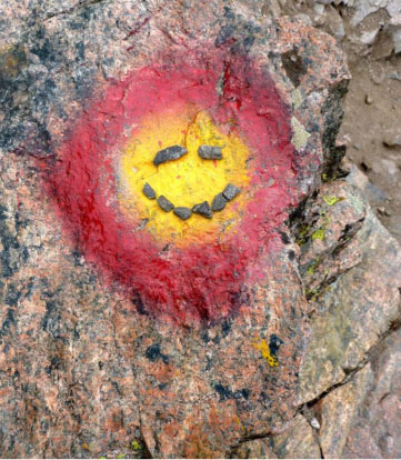
All the way back, the red and yellow bulls-eyes marked the way. I became very enamored with them. With weather threatening we didn’t want to have to take any time route finding.
Rick P. noticed my infatuation with the bulls-eyes, and made a Happy Face on one of them!
Finally, we got back to the Keyhole with the rain still holding off. The winds going through that hole, however made one feel as if you could take flight if you didn’t hold on. Longs, has the highest recorded wind gusts, which can approach 200 mph. Thankfully we didn’t experience that!
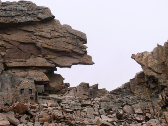
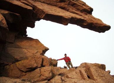
Full view of the Keyhole with the Agnes Vaille Memorial Shelter shown on the left.
In 1925, Agnes Vaille, a famous climber, attempted the first winter ascent of the East Face of Long’s Peak. She reached the summit, but on the way down, in a blizzard, she fell and was unable to continue. Her partner left her sheltered in several huge boulders and went down for help. When he returned with a rescue party several hours later she was dead. So she got a memorial. That stone hut is 10’ high.
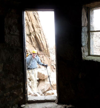
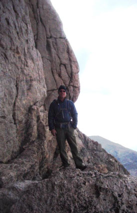
Rick at the doorway to the Agnes Memorial.
Longs Peak has quite a death history even after the fact that two out of three who start out to climb Longs turn back at the keyhole:
55 people have died while attempting to climb Longs Peak. Of those 55 fatalities, 35 were from falls.
Other reasons include exposure (8), heart attacks (6), lightning (2), suicide (2), lost (1) and falling rock (1).
Since 1970, an average of one person has been killed on Longs per year, which are pretty good odds, really unless you are the one!
By the time we got back to the campsite, the rain had started (mercifully not while we were down-climbing) and we had to make a decision – take cover in the tents or pack up in the rain and make a run for it – well more like a several hour hike, over half of which would be above tree line exposed. If it was just rain, we would get a bit wet, but if it turned electrical – not good.
Amazingly within ten minutes we actually saw some clearing coming from the south (over the keyhole) and so we packed up and went for it.
The hike down, with full backpacks, was 2 ¼ hours, 3300’ and 7 miles, with the rain threatening all the way, but nothing major until … at 6:15pm as we approached the car at trailhead, the heavens opened … and the rain continued all the way back as far as Vail!
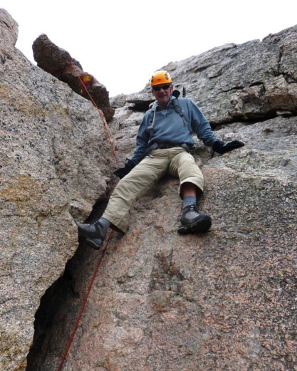
Nearing trailhead, Rick P. still looking somewhat chipper … Rick C.: not so much.
The whole route as tracked by Spot satellite service.
This was a super-fun climb, lots of interesting challenges, lots of beauty and definitely some new experiences.
I can only agree with Enos Mills, a naturalist, climber and father of Rocky Mountain National Park who climbed Longs Peak 297 times in his life, who wrote:
“Climbing a high peak occasionally will not only postpone death but will give continuous intensity to the joy of living.”
[/eleven_col]