


Total Trekking: 95km (65 miles) Rick Crandall November 19 – 26, 2011
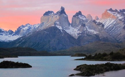
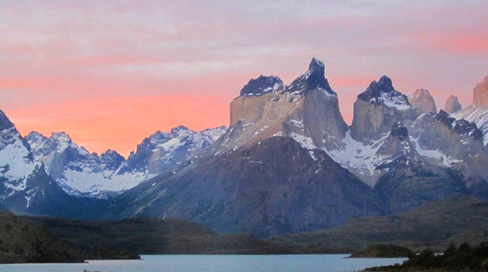
Torres del Paine is a mountain massif that is a national park of Chile, near the southern tip of South America, 5 hours driving from Punta Arenas. The Park floor is at 170’ above sea level and the peaks range up to 9000’. They are highly sculptured, originally underground volcanic cores with surrounding ground and façade material scraped away by glaciers and eroded by wind and rain. The result is an impressive collection of “towers” and “horns” emerging abruptly from the flat pampas plains. Torres means towers and Paine is said to mean “blue” in the original local Indian language.
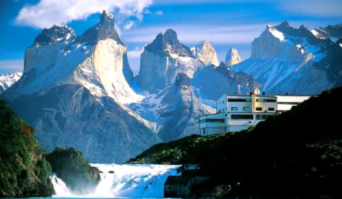
Torres del Paine and our Salto Chico hotel; the “horns” are the two sharp highest points below.
Most of the hiking trails are to the base of the towers or to lookout points that reach 2000 to 3000’ elevation gain. Climbing the peaks is dangerous Class 5 (technical) action with lots of failure due to severe weather (winds).
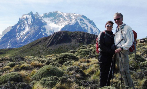
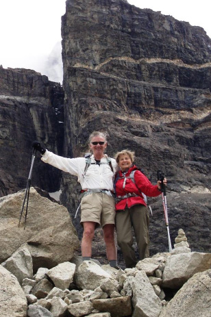
Pamela and Rick trekking in the tundra.
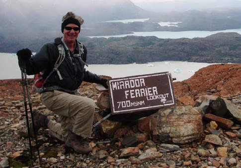
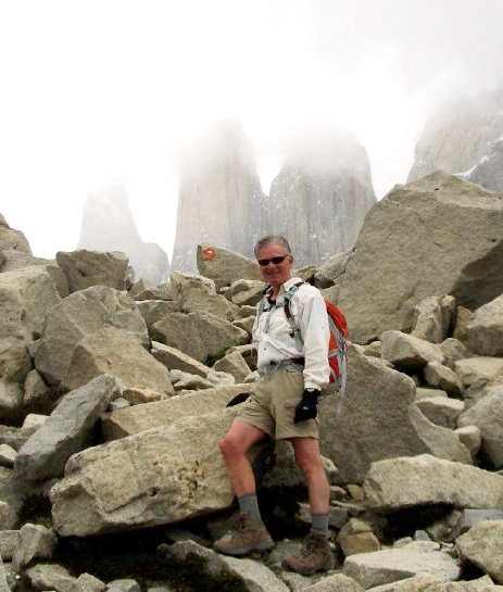
Lookout point approach to Mt. Ferrier (false summit to the peak shown below).
The most aggressive hike is a 7 km haul up a very steep grade (700 meters in one mile) to Ferrier lookout point. This is an impressive view of the uninviting peak of ice walls, loose conglomerate rock and high winds and snow which are the norm. I went with a climber, Raymundo, a 29 year old Chilean who attempted the summit a year prior and has a harrowing story of camping overnight within reach of the summit with his climbing partner Benjamin. The two were sleeping in their tent that was weighted down by heavy rocks on all sides. The wind picked up so strongly, the rocks were flung aside, the two climbers and their tent were literally lifted off the ground forcing them to scramble out and lose the tent and most of their equipment. Raymundo was left with one boot and one sneaker, both for the same foot. They immediately fought their way downhill and several hundred feet down, Raymundo found his other boot! That was the end of that attempt, which is the usual outcome. They’ve not tried again.
These mountains are severe even without weather conditions, but with high winds, snow and ice frozen so hard it is difficult to get ice screws set, the challenges are magnified.
Patagonia is the only landmass in the world at the 51st latitude and it uniquely separates the Pacific Ocean to the west from the Atlantic to the east by a narrowed land mass. The Pacific side is usually high pressure and the Atlantic is lower pressure creating a condition of nearly constant high winds, at times reaching 70 mph. Complicating the matter are two glaciers on the western side which cool the air coming from the Pacific creating many cloud systems the blow in and out with the winds. Weather easily changes several times/day. We were lucky with good weather for 7 of our 8 days in this wild country.
To Gray Glacier
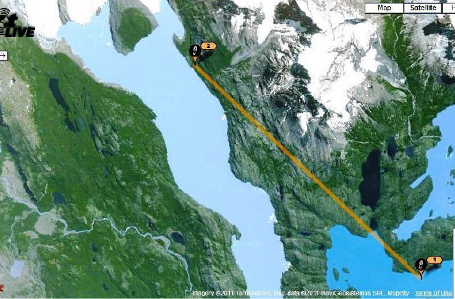
SPOT tracking only sent two points (beginning and end) to the satellite for the Grey Glacier hike, a 12km trek mainly through woods.
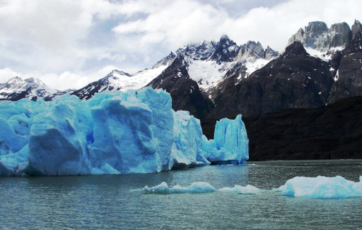
Glacier edge – the blue color is real – cold, compressed ice.
Activities are mainly hiking/trekking and horseback riding with the gauchos on the pampas. There is a circuit called the “W” due to the shape of the trekking routes around the massif.
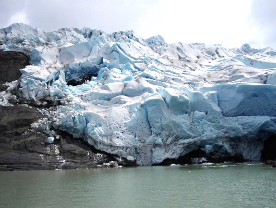
Gray Glacier – still shaping the local geology.
The left leg of the W is a 12 km walk to Grey glacier and icebergs.
To the Base of Las Torres
The next leg of the “W” is a hike to the base of the actual “torres” or towers from which the park’s name derives. The hike is 18 km and treks through mature beech forests leading to steeper inclines through rocky moraines, but with excellent ranger work easing the footpaths.
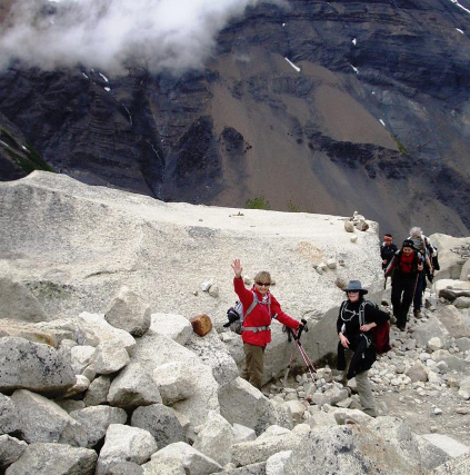
En route to the base of the “torres”
The towers are 3 spikes rising vertically several thousand feet from a mountain lake, and often enshrouded in clouds. In fact they had been hiding in clouds for days, and looked to stay that way when we approached. We joked with our guide, Isabella that we had special spiritual energy we were directing to part the clouds when we got to the vista point, but as you can see, that was looking increasingly improbable. At one point Isabella said “if those clouds part and the towers expose, I’ll change my religion!”
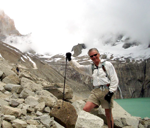
Above: clouds lifting …..
YES!! Les tres torres
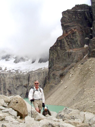
Rick and Tania – triumphant in their “special powers” heading down – and wouldn’t you know it, minutes later the cloud cover returned and didn’t clear again that afternoon.
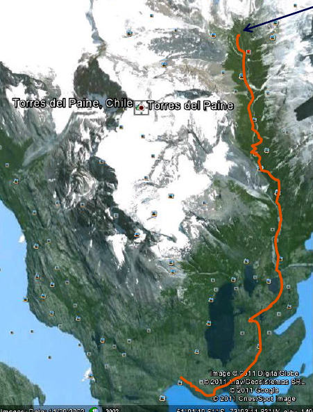
The “W” signature trek of the Park. We did it in 3 days on separate legs each from the hotel (solid lines) whereas campers do it on the dotted line path which usually takes 4 or 5 days.
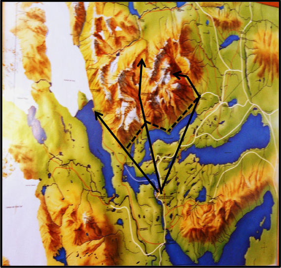
Left trek is to Gray Glacier;
Middle trek is to French Valley and the British Camp;
Right trek is to the base of the torres.
30 km Trek to the British Camp
The final leg of the W is a more aggressive hike into the massif, past the Italian camp, the French valley glacier (16km) to the “Plateau” (22km) and then on to the British camp – a total of 30 km and some bouldering from the French valley to the Plateau. This part offers striking ‘in your face” views of the “horns” and the Paine Grande Mountain which has only been summited three times ever, most recently by a Chilean woman climber.
Why the French Valley name? Because a French family owned the land before it was a National Park. The early part of the trek takes you to what is called the “Italian Camp” where several Italian climbers were the first to summit Paine Grande. The Italians used the camp as a base camp, and today it’s been enhanced and is used by Park rangers.
The Italian Camp, now a Ranger hut.
Further up the valley is a plateau where the French Glacier can be seen, “in your face” with occasional impressive and noisy ice-falls and avalanches.
French Glacier
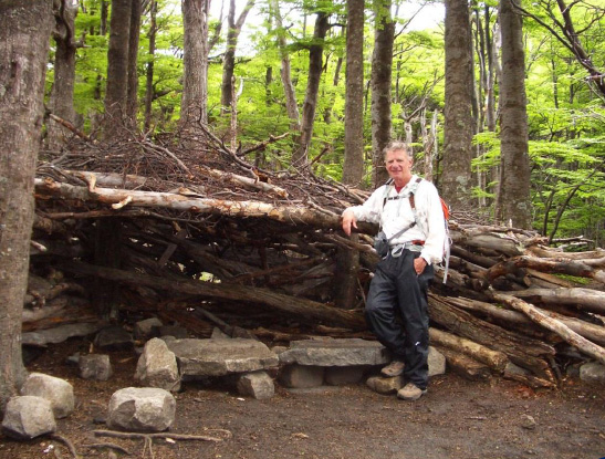
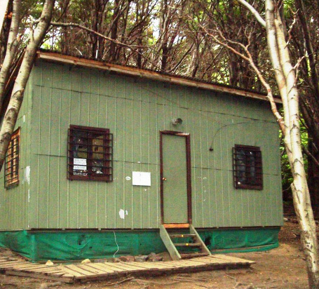
The signature trek is to go further, a full 30km up the Valley and back to the “British Camp,” which is a cluster of primitive log and twig lean-tos originally used by British climbers attempting the local peaks, sometimes enduring weeks of snow, rain and high Patagonia winds at times topping 70 mph.
We had an unusually nice-weather day.
The arrow points to British Camp
Google Earth showing our trek to the Italian and British Camps – we were in the trees a lot, so only occasional access to the Spot satellite.
There are other hikes to several lakesides, through forests and along cornices and bluffs, each offering different views of this wild part of the world… and there is horseback riding on the pampas with the guachos.
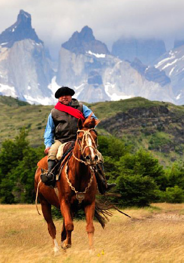
Gaucho
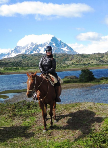
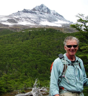
Pamela
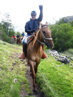
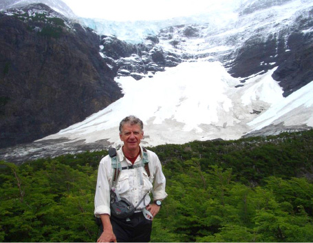
Rick
(or as Pamela likes to say: the crazy Jewish cowboy).
Los Animales de Patagonia
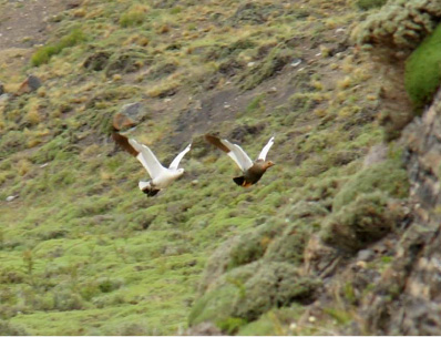
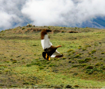
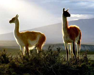
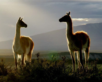
Animal life consists of Guanacos, which are a version of Llama, gray foxes, birds including flamingos, geese, ducks, rheas (like an ostrich), condors as well as hares and the elusive Puma (another name for a mountain lion).
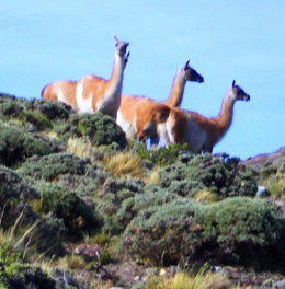
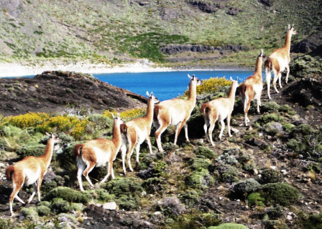
Guanacos coming over a rise … and filing past!
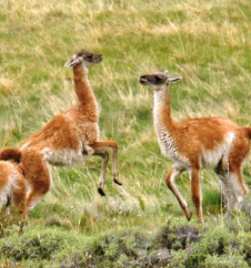
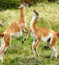
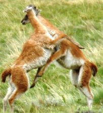
Young Guanacos frolicking on the pampas – not minding our closeness.
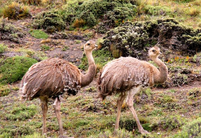
Rheas up close
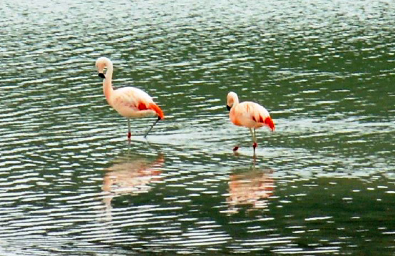
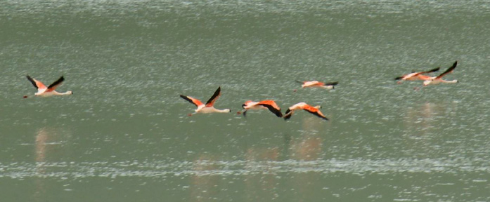
Flamingos in the Wild in Patagonia
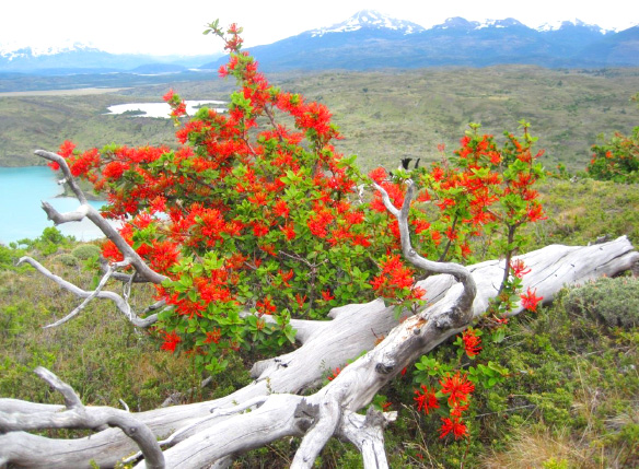
These red firebushes were everywhere – brilliant in the morning light.
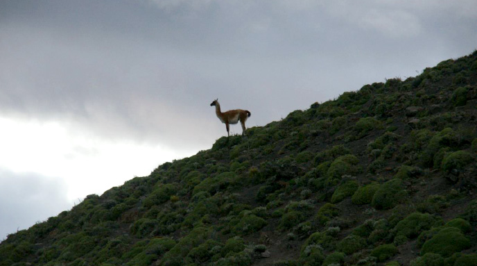
An early morning rise (5am) catches Guanacos backlit by the rising sun. The lone animal above is a typical position of the designated “guard” keeping watch over the territory – could either be a male watching over his dozen “wives” or keeping a watchful eye for their main predator, the Puma.
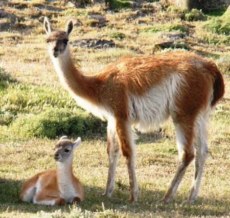
This was birthing season for many of the animal species. This newborn was just about to stand for its first time, closely watched by Mom. As we took these pictures, we heard thundering hoofs – which turned out to be the Dad hammering down the slope from above – and joining the pose for our final shot.