West Ridge and Southwest Face – New Route Ascent, Standard Route Descent
Difficulty: Class 4
Exposure: in “Hourglass gulley”
Summit: 14,037 feet
Elevation Gain: 4200 feet from campsite
Roundtrip: 8.5 miles from camp at 10,000’
Campsite: 4.8 miles up Blanca Peak “road”
Climbers: Rick Crandall, Susan & Andy Mishmash; Rick Peckham September 7, 2015
This is a pure climbing story because this mountain is a skilled-climbers’ mountain that most recognize as one of the two most difficult of all 58 Colorado fourteeners.
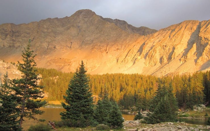
Little Bear Peak, named after a nearby lake, and its west ridge leading down to the right.
Little Bear Peak is in the south of Colorado in the Sangre de Cristo Range about 4 hours from Aspen. I’d studied this mountain for years and attempted it once before but was turned around due to the onset of a snowstorm right when I was in the crux gully. However I did see some of the challenges and came to understand first hand why the descriptions went like this:
- “Little Bear would be more appropriately named ‘Satan’s Playground’ and the hourglass-shaped summit approach is a steep, smooth gully should be named “The Devils Crotch.”
- Dangerous climbing on Class 3 and Class 4 rock, often loose … no place to be caught in a thunderstorm.
- From Summit Post and Wikipedia: Little Bear is one of the crown jewels on the Colorado 14ers. With the standard route encompassing some tough scrambling and a high level of objective danger due to rock fall, Little Bear Peak is usually one of the last 14ers that only those people climb who are trying to get all of them.The standard approach follows the infamous Lake Como Road which is considered one of the most challenging four-wheel roads in the country. Despite being one of the hardest 14ers, under the right conditions most skilled climbers will reach the summit but it’s important each climber approach this peak with respect and exercise extreme caution when climbing through and above the Hourglass. A handful of excellent climbers have died here either from climbers above knocking rocks down or from large rocks breaking free. Taking objective danger alone, this peak is probably the most dangerous 14er via its standard west-ridge route.
- Little Bear is one of the peaks that falls on just about anyone’s list of the “hardest” 14ers. What makes Little Bear deserving of such categorization is the route’s crux, a steep Class IV gully known as the Bowling Alley or Hourglass. Not only is this gully a difficult climb, but the danger is compounded by several hundred feet of loose Class III climbing above it, where any rock knocked loose by climbers above is guaranteed to shoot through the Bowling Alley at lethal speeds. Needless to say, helmets and good coordination of climbers is absolutely essential when climbing Little Bear Peak.
- From 14ers.com: This loose, dangerous route is probably the most difficult standard 14er route. Climbing this route on a busy weekend is definitely not recommended.
I’ve never been nervous on a climb, with the exception of a few skirmishes with electrical storms. But Little Bear was playing games with my brain. So there’s only one expert climber I know who I’d trust to attempt it with, and he’s a good friend which makes any experience even better – Andy Mishmash. He’s been in several other stories of the tougher climbs like:
Pyramid (see: https://www.rickcrandall.net/pyramid-peak-a-dream-climb-2/) and
North Maroon Peak (see: https://www.rickcrandall.net/north-maroon-peak-going-technical/ ).
Andy grew up in Colorado climbing mountains. He’s a top technical climber and ice climber who has mastered more mountains than I can recite. Even better, he just enjoys the outing and applies no pressure for speed, nor does he get summit fever as some who will ignore weather or other risks.
Andy knew of my apprehension about this mountain, but if I had a hope of climbing all 57, I needed to get this one. This summer of 2015 presented weather challenges in Colorado. Almost daily thunderstorms from the southwest were complicated by lots of smoke from the fires in Oregon and Washington. We were watching the detailed forecasts daily and finally it looked good for a “hole” in the pattern for two days, which is what we needed.
Andy had a commitment to be in Fort Collins the night of our climb, so the plan was for he and his wife Susan (also a Class 5 technical climber) to shoot ahead of us once we were down from the crux of the climb and that would leave me and Rick Peckham to finish out the rest of the climb and hike out. Rick is well known to the reader as Rick P. – a great guy to have along on any climb.
We took two cars – both Toyota’s with TRD Pro features for off-road. Mine is new (4Runner TRD Pro) that I drove about 3.4 miles up the 7.5 mile nightmare road now called Blanca Peak Road (was called the Lake Como Road). Rick P. and I waited, having parked our car at a pull-off and Andy and Susan came along with their Tundra TRD and picked us up. He took us further to the 4.8 mile point, over even tougher conditions, literally driving over boulders and other scary stuff.
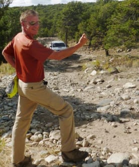
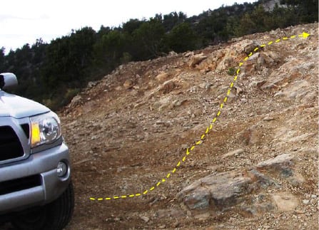
Andy made that left – scary!
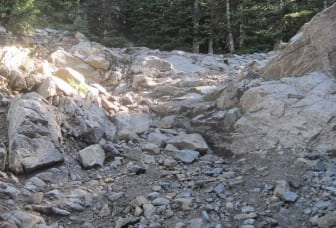
… and the road gets worse!
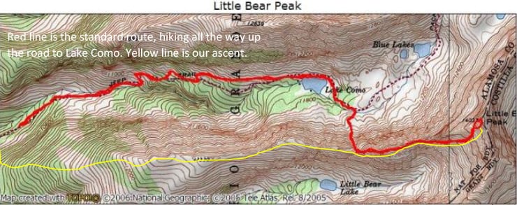
On a previous climb, Andy had discovered that instead of backpacking up the rest of this horrendous road (that is even hard to walk on) and camp at Lake Como, it was possible to acquire the west ridge from the lower point where we stopped on the road and camped. The benefits of avoiding the standard approach to Little Bear from the lake are that it avoids a very aggressive bear we’d encountered earlier in the summer on our Blanca Peak climb, and it also avoided climbing to the ridge through a 150’ boulder field and then a 600’ loose, ugly gully. The deficit is that it adds 2.5 miles and 2000’ to the climb on climb day, but through friendly and enjoyable terrain.
Given the extra distance and vertical gain on the day of the climb, and the level of difficulty at the crux and above, we awoke early at 2 am and started hiking towards the ridge in the dark at 2:20 am.
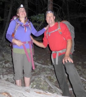
Susan and Andy at the start of our climb.
Having now done the climb on this new approach, I recommend it to others attempting this mountain. The climb to the ridge is through a forest but plenty of hiking room between trees. Once you get to the ridge and turn left, the entire ridge walk is easy and a pleasure, almost to where in intersects the standard trail where the gully comes up from the lake. Take care to mark the return off the ridge to get back to camp – the ridge can fool you.
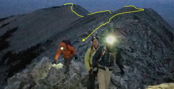
The yellow line is the ridge walk from our campsite just off the road at 10,000’. We did much of the ridge in the dark which was no problem.

A friend recently bought me for my birthday a reading by a well-known astrologist. Among many things he told me is that my dominant planet is Venus which has brought me into a happy period that will last for quite a long time. I’m not the strongest believer in astrology, but this morning as dawn appeared, there was Venus just to the right of the Little Bear summit. Did that mean I would achieve the joy of the climb and reaching summit with my friends today?
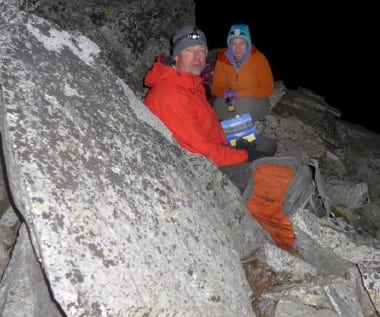
Andy and Susan on the side of the ridge out of the wind stopping for breakfast (Mountain House dehydrated ‘Granola, Milk and Blueberries.” We pour the water into the pack at camp and eat an hour or two into a climb when we’ve got more appetite.
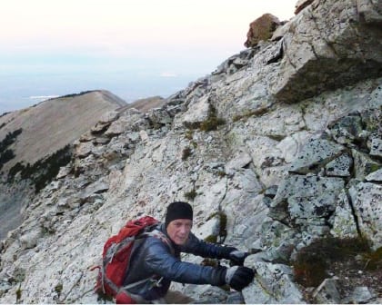
Rick scrambling an increasingly rocky ridge
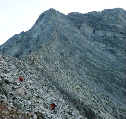
Andy and Susan hiking towards the southwest face.
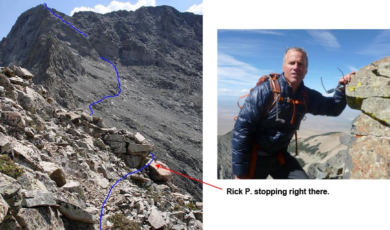
At 12,750’ on the south side of the ridge – the rest of the route is visible. It looks like pebbles in the distance, but the scale fools you- those are all boulders.
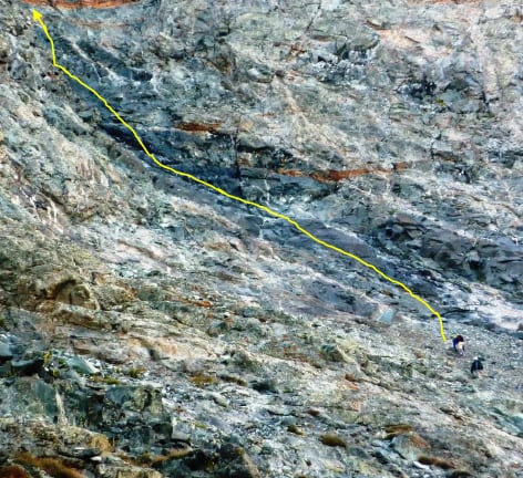
Here is the scale of things as we approach the bottom of the gully that culminates in the Hourglass above. Those are two climbers at the start of the yellow line.
Here is one reason why I worried so much about this mountain. In The last attempt on September 10, 2011, almost exactly 4 years ago, I started up this very gully. I saw firsthand, it was not only smooth and steep – it was wet and covered in ice. That day a storm threatened that turned into a snowstorm forcing us to retreat, but that view of the gully haunted me.
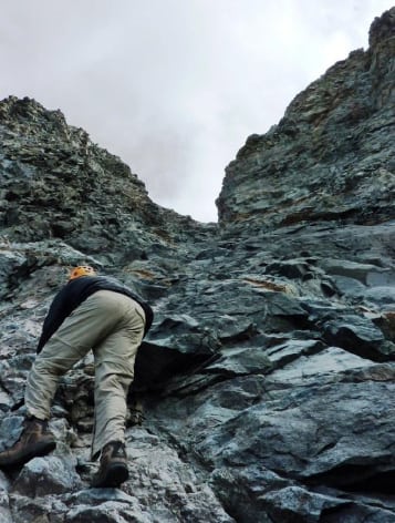
Rick in the Hourglass in 2011
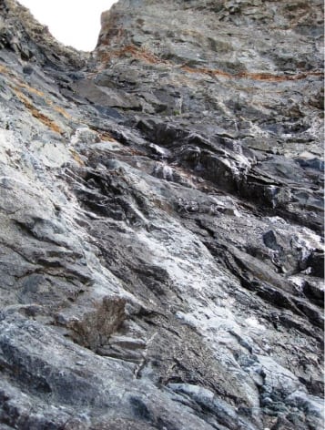
The shiny stuff is ice, the rest is wet.
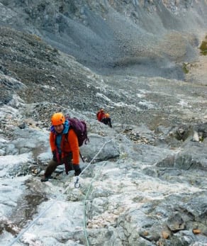 The other reason is the gully’s reputation, reflected in its alternate name – The Bowling Alley. Its hourglass shape opens wide at the top gathering every rock that is loosened above, all the way to summit. They shoot through the narrow part of the Hourglass with great speed. You can improve the odds of no mishap by communicating with and staging other climbers so that no one is moving above when you are in the gully. But that’s not the only way rocks come careening through as I was about to learn.
We knew there was a fixed rope down the middle of the gully that most use in the crux. You can see it next to Susan’s left arm as she starts up.
When I grabbed the line to test it, a boulder loosened, that was nearly a bowling ball in size. Rick P. yelled “ROCK” and I jumped to the side, but it followed me and struck my calf muscle that was fortunately flexed and absorbed the blow. I felt pain but nothing broken so I went on. That was my other worry.
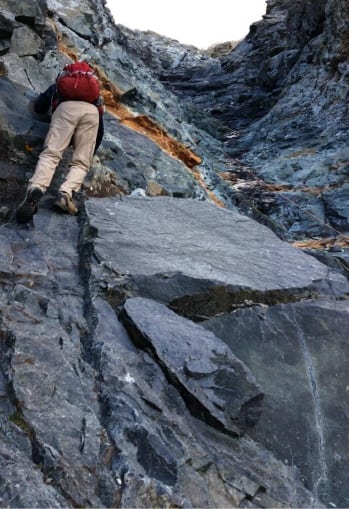
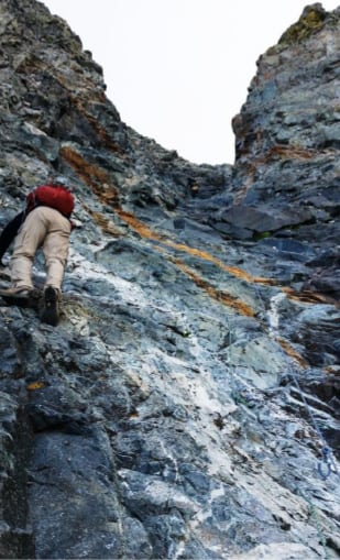
Today’s climb in the Hourglass. I was free-climbing towards the narrow crux and actually having fun. There was still water in the very middle, but plenty of room to climb on the left side.
Rick P. and Susan went up first. There were three climbers at summit and not planning to come down any time soon. That reduced the risk of rock fall. Then as I approached the narrow part of the gully, Andy unloaded some of his “gear” from his pack – I was going to have protection. He put a Jumar (an old name for an ascender) on the fixed line, put a harness on me and connected it to the Jumar and up I went, happy as a clam! You still mainly use your feet to find holds and push up, but the Jumar gives you balance and belaying protection.
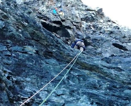
Rick using a Jumar to ascend up the gut of the Hourglass. Susan and Rick P. are watching from above.

Jumar – lets you push up a rope freely, but when you pull down it grabs tight.
The Hourglass gully is about 250’ of vertical from about 13,300’ to 13,550’ where you can exit left. The remaining 480’ to summit is described as follows from 14ers.com:
It‘s decision time again. The remaining route to the summit is loose and dangerous. Route finding is a bit of an issue, but a major problem is keeping rocks from falling into the gully. The terrain spreads out and there is no clean line to the summit. The best way is to climb left away from the fixed-rope anchor on the most solid rock you can find
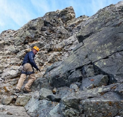
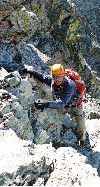
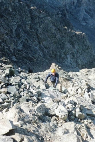
The final 480’ to summit is a lot of climbing on loose rock, with the Hourglass just below ready to catch and hurdle anything you kick loose.
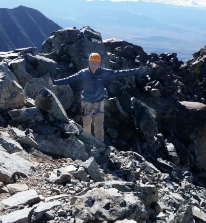
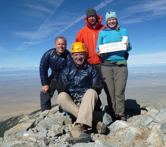
Summit Little Bear Peak, 14,037’ at 9:27am, 7 hours, 4200’ and 4.25 miles from campsite.
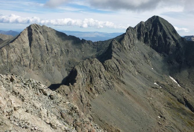
The view to the east from the summit of Little Bear is awesome. On the left is Ellingwood Pt. at 14, 048’ and on the right is Blanca Peak towering at 14, 351’. The ridge from Blanca to Little Bear is reputed the most difficult of the classic traverses.
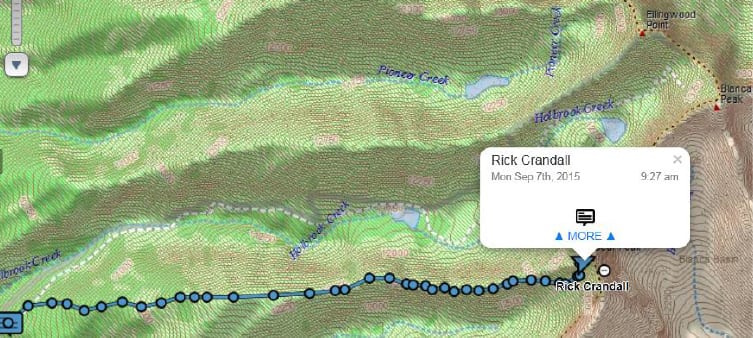
DeLorme InReach track of our climb.
Well as you all know by now, summiting is about 40% of the challenge. Descending at least down past all the cruxes and difficulties and doing it in time to avoid lightning storms, is the other 60%. I don’t celebrate until then.
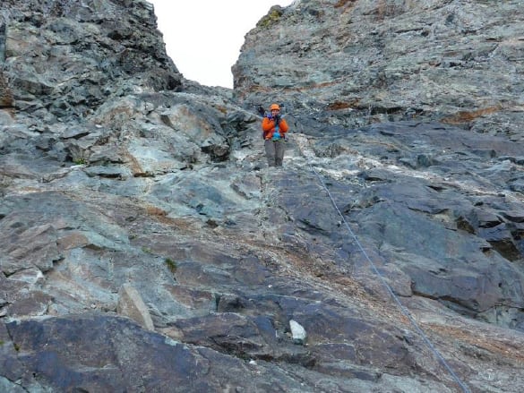
Susan heading back down the Hourglass, after Rick P. zipped down, both using the fixed rope that was judged to be in good shape.
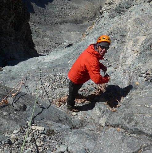
As for me, Andy had more goodies in his pack which I was relieved to see. He’d brought 200’ of rope and other gear so he could lower me via rappel down the troublesome part of the gully.
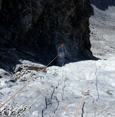
Even at that it had its challenges. The middle of the gully was wet – it’s always wet and slimy-slippery. I needed to lean all the way out perpendicular to the wall to stop my feet from slipping out from under me on the way down. Where I could I walked to one side or the other of the center.
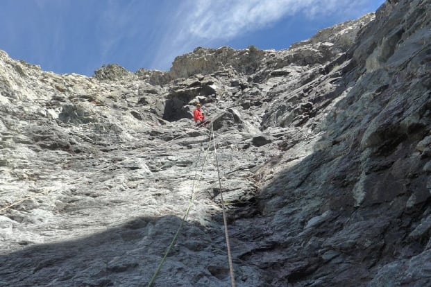
I took a picture looking up of Andyfrom the rappel, me yelling “do you still have more line?”
And Andy took a picture of me going down.
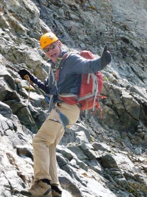
Here I’m nearing the end of the rope and at a place where I could stand – feeling real good!
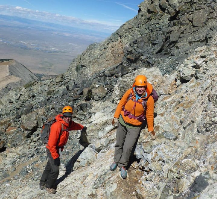
At that point we were past the difficulties of this “bear” of a peak. We still had hours of down-climbing, hiking, breaking camp, backpacking to the car and driving down that miserable road.
But recall Andy had a commitment to get to Fort Collins yet that evening so we agreed that was where they were to race ahead and Rick P. and I would continue on at my pace.
Right at that point all the emotion hit me – in fact overwhelmed me. It was 12 noon and we’d done it – we’d mastered the toughest, baddest 14er of the 57. Yes I’d researched, planned, worked out like a madman and studied weather like a Phd, but it was Andy that enabled me to get up and down that mountain safely.
As I tried to thank him, tears blasted into my sunglasses and I choked to where I couldn’t talk. At first I was glad my sunglasses were hiding the tears and then I realized there’s nothing wrong with having a powerful emotion of joy, thankfulness and appreciation for what one good friend can do for another. He knows how much I love these mountains. We hugged, I choked out a “thank you for the joy of today” and he and Susan took off like race horses.
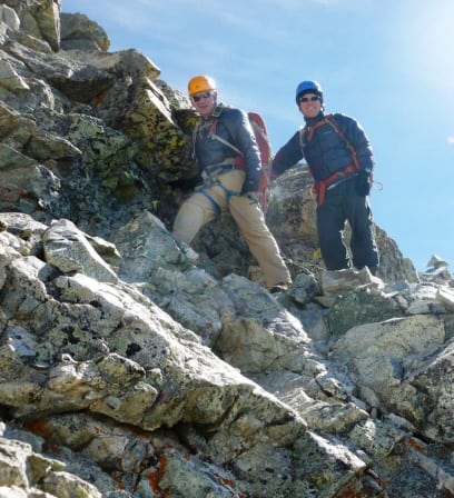
Rick P. had a ball on this mountain. He mastered it by himself and now took over leading the rest of our descent. Together we headed down with huge grins.
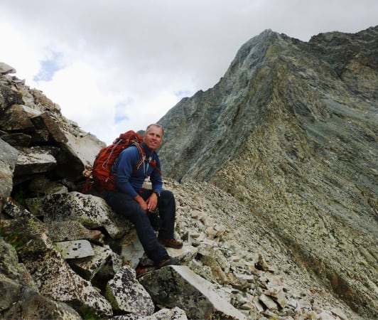
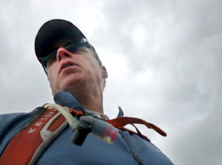
But oh oh, I didn’t like the gathering clouds darkening above that you can see in this picture to the east of Little Bear Peak.
I expressed my concerns to Rick P. It looked like the winds were coming from the southwest and in that direction things didn’t look too bad, but funny things happen with big mountains. Weather can come in from the wind so you can see it coming, but it can also rise vertically up the sides of the mountain (called convection) and gather near the peak. The rising motion creates cloud masses and then rain. Even worse, the upward movement against the mountain causes static electricity buildup and then next think you know you’ve got lightning – which is the only thing that really scares me being up that high.
Rick P. took a shot of me with worried face and gathering clouds above.
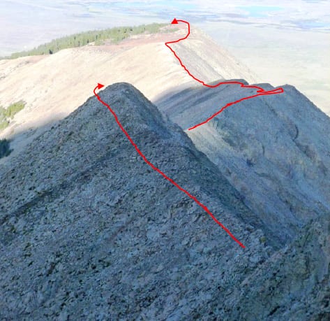
We debated for a few minutes. That gully is loose, steep, slippery and ugly. But it was right there – we’d be down to the Lake in an hour, even taking great care to avoid a fall.
We opted for the gully.
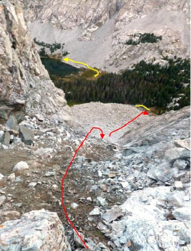
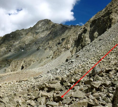
The top of the 600’ gully. You can see the boulder field at the bottom and Lake Como to the left. The road is in yellow.
At the bottom of the gully looking back to Little Bear Peak. As it turns out the clouds did pass by and we had another perfect weather day.
We then hiked around the lake, ground down 2 ½ miles to our camp by 5 pm to pack up and hike another 1.5 miles down to our car.
We packed up and headed down the 1.5 miles reaching the car just after sunset at about 7:40 pm. In total, we’d been at it for 17 ½ hours and we still had to drive down the rest of that ugly road and another 4 hours back to Aspen, but we were happy.
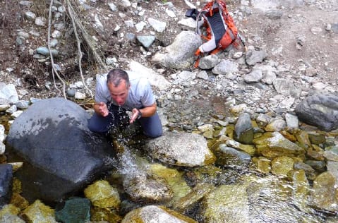
Rick P. refreshing in a stream at about 4 pm. We’d been hiking and climbing since 2:20 am and we weren’t done yet!
The whole roundtrip. Bottom track is the ascent from camp to summit. Top track is return from summit and bailing at the gully heading down north to the road and then hiking down the road.
Some combination of Andy, Rick P. Susan … and even Venus got me up and down the baddest Colorado 14er – and we not only summited, we had a great, fun and joyful day of challenge, beauty, problem solving, endurance and success.
How often do you get that kind of opportunity?
